Surveying and Mapping Engineering School traces its origins to the Engineering Teaching and Research Group established in 1952. Following institutional restructuring in 2015, the former Department of Geomatics Engineering was renamed to its current designation. The School now comprises 61 faculty members, including 14 professors, associate professors, and senior engineers. In 2012, the Engineering Surveying Technology teaching team was designated as a National-Level Teaching Team, while in 2021, the Geomatics and Geographic Information Technology program cluster was honored as a "Huang Danian-Style Teaching Team" by Henan Province. The faculty boasts 1 National-Level Distinguished Teacher, 2 National Water Conservancy Vocational Education Distinguished Teachers, 7 National Course Ideology and Politics Distinguished Teachers, along with 14 recipients of Henan Province's "Da Mei Xue Gong" award (Excellence in Student Affairs) and municipal outstanding teacher honors. Additionally, the team includes 6 Henan Provincial Academic Technology Leaders and over 20 professionals holding certifications such as Licensed Surveyor and UAV Chief Pilot.
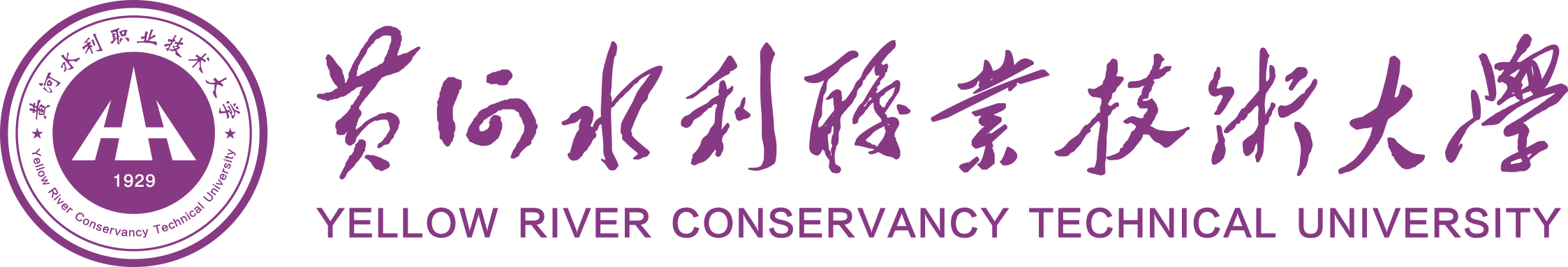
Students Receive UAV Training
The School possesses 2 National-Level Quality Courses, 2 National-Level Quality Resource-Sharing Courses, and 1 National-Level Course Ideology and Politics Demonstration Course. It has led the development of the National Geomatics Professional Teaching Resource Database and received 2 Second Prizes in National Teaching Achievement Awards. Faculty members have edited 13 national planning textbooks during the 12th and 13th Five-Year Plan periods, earning 1 First Prize and 1 Second Prize in National Excellent Textbook Awards. The School has conducted seven national and provincial training programs for "Backbone Geomatics Teachers in Higher Vocational Education," specializing in UAV and GNSS technologies, and was honored as a National Outstanding Contributor to Skilled Talent Cultivation and a National Demonstration Virtual Simulation Training Base for Geomatics. Over the past five years, faculty teams have achieved 3 awards at or above the Third Prize level in National Teacher Teaching Competency Competitions, 11 First Prizes or higher in National Geomatics Teaching Competency Competitions, and 5 awards at or above the Second Prize level in Provincial Teacher Teaching Competency Competitions.
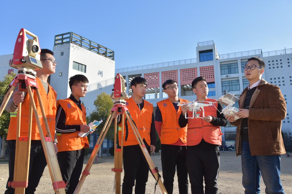
Students Achieve 7 Consecutive National Championships at Vocational College Skills Competition
The School has appointed Wang Jiayao, Academician of the Chinese Academy of Engineering, as the "Chief Scientist" for its Geomatics and Geographic Information Technology program cluster, establishing an academician-led "Spatio-temporal Big Data" research and innovation team with cross-disciplinary integration. The School has recruited Liu Haojie, a top-tier industry professional, as Dean of the Industrial College for this program cluster, while establishing Modern Surveying and Mapping Master Studios led by experts including Cheng Xiaoqing and Xu Wenzhong. This initiative has cultivated a dual-qualified (academic and professional) faculty team centered around the academician, complemented by a specialized research and service group. The structure has effectively promoted the close integration of industry, academia, research, innovation and application, while driving comprehensive enhancement of faculty capabilities and professional competencies.
The School currently offers six majors with one specialized track: Engineering Surveying Technology (including Modern Apprenticeship Program) (a key national "Double-High" construction major, national model construction major, and national modern apprenticeship pilot program), Geomatics and Geographic Information Technology (national "Double-High" construction major, Henan Provincial comprehensive reform pilot major), Photogrammetry and Remote Sensing Technology (national "Double-High" construction major, national characteristic major in water conservancy vocational education), UAV Surveying and Mapping Technology (national "Double-High" construction major, national characteristic major in water conservancy vocational education), Surveying and Mapping Engineering Technology (national "Double-High" construction major), and Cadastral Surveying and Land Management (national "Double-High" construction major). In 2019, the Geomatics and Geographic Information Technology program cluster was selected as a Class A (top 10 nationally) construction unit under China's "Double-High Plan" for developing distinctive high-level vocational programs. Currently undertaking education at both college and undergraduate levels, the School enrolls 2,242 students and has cultivated over 50,000 surveying and mapping professionals for society. These graduates have made significant contributions to national projects in water conservancy, geomatics, construction, and transportation sectors.
The School boasts state-of-the-art teaching facilities, including: a high-speed rail track precision measurement training field, a virtual simulation training base, and a Geomatics and Geographic Information Technology training center. With total equipment assets exceeding 70 million yuan, the School's key resources comprise: 60 sets of GPS receivers, 48 digital photogrammetry workstations, over 200 total stations, 2 measurement robots, 2 underwater surveying systems, and 40 precision electronic levels. The School has undertaken more than 50 major surveying projects, including: wind farm mapping in Ethiopia, Africa, construction surveys for Shijiazhuang-Wuhan and Beijing-Shanghai high-speed railways, UAV surveys for water body protection under the Ministry of Water Resources, central route surveys for the South-North Water Diversion Project, and Rural planning surveys for new countryside development. These initiatives have generated substantial economic returns and social benefits.
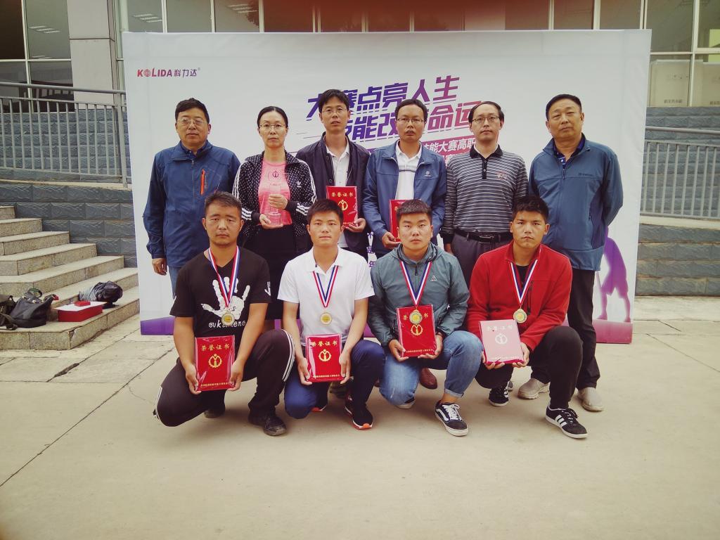
Faculty from Northwestern Michigan College (U.S.) Teaches Underwater Topographic Surveying
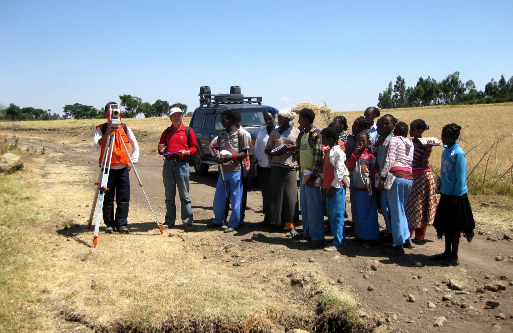
Students Conduct On-the-Job Training for Wind Farm Surveying in Ethiopia
Since 2012, students have won over 50 national first prizes in surveying skills competitions, including a seven-year consecutive championship (2012-2018) at the National Vocational College Surveying Skills Competition hosted by the Ministry of Education. The School maintains close industry-academia collaboration with Class-A/B surveying enterprises such as STECOL CORPORATION, China Gezhouba Group Company Limited, and Henan Institute of Surveying and Mapping. Through comprehensive "production-embedded education," it cultivates high-skilled technicians for frontline operations in: water conservancy, geomatics, construction, and rail transit. The School boasts an employment rate of over 98% and has nurtured numerous outstanding graduates, including: Fan Lianyong, National Model Worker, Sun Guangwen, National Technical Expert, Wang Zhihao, National Youth Post Expert and Provincial May 1st Labor Medal recipient, Li Zufeng, one of the "Top 10 Craftsmen" at PowerChina Group, Ma Qiang, Li Yi, and Zhang Weidong, members of the 2020 Mount Everest Survey Expedition. These graduates have earned high praise from employers, contributing to the School's strong social reputation.
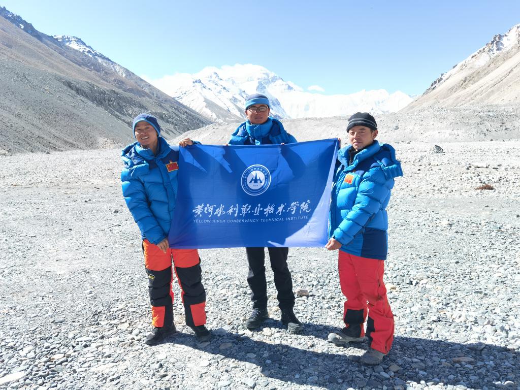 Graduates Participate in 2020 Mount Everest Height Measurement